

measured from satellites.
Overall that means a yearly subsidence rate of about 9.5 inches (24 centimeters). Over the course of less than a century, the drop has been more than 39 feet (12 meters), according to Cabral.
Holy shit.
I guess the “lucky” part is that it’s sinking evenly. Otherwise buildings would be collapsing all the time.
IDK that seems scarier to me. If the whole thing is sinking evenly, what happens if/when whatever is holding it up gives way completely? Is the whole city going to fall into a sinkhole? Will there be stories of the lost city of Mexico City in a few thousand years?
There’s an aquifer under the city that supplies the city’s water which they’re pumping dry.
The relentless pumping of groundwater and extensive urban development have severely depleted the underlying aquifer.
Yeah that’s what made me think, “what happens when there’s a giant cavity under the city and the water is gone?”
Best case: gradually sinking into a city sized sink hole.
Worst case: “aaaaahhh” crunch.
All of the clay gets compressed which means the water can’t drain into the ground anymore and the underground drainage canals get damaged. And then the city turns back into a fucking lake after it goes between drought and flooding because the only way to create a surface water reservoir is to turn the now sunken city back into a goddamn toxic and polluted lake/marsh. That or attempt to geoengineer it into a desert which also defeats the purpose of human habitation. Eventually “fixing” the problems will become more expensive than what they’re worth for more development but nobody really knows where that inflection point lies for the valley of Mexico.
I assume there’s a bottom at some point. Bedrock or something like that. But idk I’m not a geologist.
Consistently multiple inches a year is actually insane
One must pose the question, then:
…Where is it going?
Edit: thinks about tectonic plates … Oh no…
In this case it’s compressing because the water has been drained. It used to be a lake. Same problem in New Orleans.
Ahhhh… That’s better than a gap in the earth opening and sending one of the largest cities on earth between tectonic plates to basically hell
It’s gonna sink like the artifact from Indiana Jones and cause the Yellowstone supervolcano to erupt lol
“Spotted” is still also accurate. How do you think a satellite could measure anything, except by looking at it?
Because it’s click bait sensationalism.
Emphasis mine;
The NASA estimates are based on measurements taken between October 2025 and January 2026 by a powerful satellite known as NISAR, which can track real-time changes on the Earth’s surface and is a joint initiative between NASA and the Indian Space Research Organization.
NISAR
https://en.wikipedia.org/wiki/NISAR_(satellite) :
The NASA-ISRO Synthetic Aperture Radar (NISAR) mission is a joint project between NASA and ISRO to co-develop and launch an Earth observation satellite (EOS) equipped with dual-frequency synthetic aperture radar (SAR) in 2025. It will be the first radar imaging [emphasis added] satellite to use dual frequencies.
https://en.wikipedia.org/wiki/Imaging_radar :
Imaging radar is an application of radar which is used to create two-dimensional images, typically of landscapes. Imaging radar provides its light to illuminate an area on the ground and take a picture at radio wavelengths.
It is, in a literal sense, “spotting” the subsidence using visual techniques, albeit at a lower EM frequency than what humans can see.
Sigh.
If you are using a camera, what is doing the spotting (or more broadly observing)? You or the device?
Are you trying to suggest that there’s no such thing as “spotting” anything from a satellite unless a human astronaut is riding inside it?
That’s not impressive any more. We have laser ranging systems that can spot the vibrations of a butterfly landing from space. We can spot pretty much anything from space these days.
We can spot pretty much anything from space these days.
hurriedly closes blinds before resuming masturbation
Ok, fine. I guess there really is a minimum size limit.
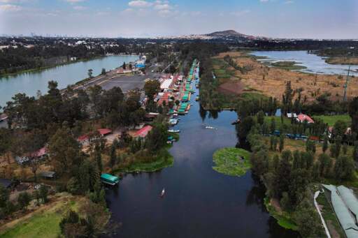
It was built on a lake after all.
Went there a couple years ago to go see the ruins. A lot of the colonial buildings are leaning at strong angles.
Fuck I miss Mexico.
What are several of the things you miss about it?
The food especially nopales and agua fresca. Deep cut American classic rock being blasted at me from shops and Uber drivers. The people are generally interested in why I’m so stoked to be there, I loved answering questions. Indigenous ruins and archeology zones. I’m from Texas, so it was constantly fascinating figuring out some of the origins of cultural keystones I didn’t realize shaped my life.
It was such a better time in my life than what I’m struggling with now. That’s probably too personal to be a good answer, but it’s an honest one.